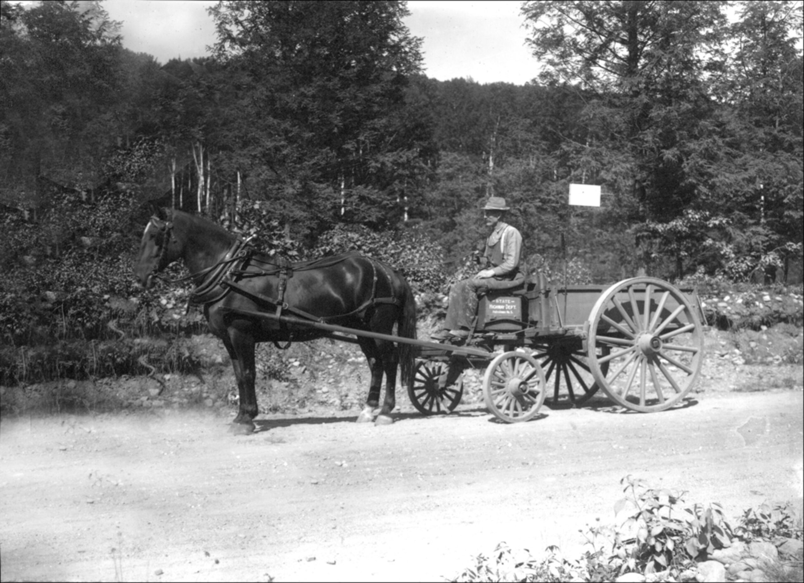
It would probably surprise you to know just how much of your daily life is influenced by the amount of time it used to take a farmer with a horse-drawn wagon to get from Stilesville to Danville.
If you’ve ever looked at a map of Indiana’s 92 counties, you’ve noticed that while shapes vary, most of them are about the same size. The average for the counties is 396 square miles, and Hendricks County is definitely in that neighborhood, with just under 407. Allen County, which surrounds Fort Wayne, is the largest at 657, with Cincinnati neighbor Ohio County the smallest, at just 86 square miles.
The first county, Knox, was formed in 1790 when this part of the continent was known as the Northwest Territory. The youngest, northwest Indiana’s Newton, became #92 in 1859.
When Indiana’s early leaders partitioned the state into counties, they had to decide what they thought was the ideal size. State law assigns many responsibilities to local government, so it was important for governmental units to be the right size. Make counties too large, and they become tough to manage. The ordinary folks — people very much like you — who were chosen to lead our young state chose a size that allowed a farmer from the county’s furthest reaches to travel by horse and wagon to the county seat and back during daylight. That would ensure all the county’s residents would be able to transact any business they had with county government.
They weren’t finished there. In 1851, Indiana adopted its second constitution (after the state went broke — more on that another day), which formalized the division of counties into townships, typically about 36 square miles in area. Each township was headed by a trustee, who was essentially the local government. The trustees addressed important services, from fire protection, to ensuring residents kept drainage ditches clean, to helping people who had become destitute. For many decades, they were even responsible for overseeing schools.
Those county lines and township borders influence our lives in ways we don’t even consider. While all six of Hendricks County’s school districts moved from township trustee control to school boards many decades ago, those township lines continue to define their boundaries. The old township schools were consolidated into larger districts. Why? Because that’s what the people in the Statehouse believed would give more students opportunities to succeed.
It’s been a mighty long time since farmers guided their horses back home after an interaction with the folks in Danville, but the conditions of those days continue to shape how local government works today. Some might call it obsolete, but it works remarkably well.